
www.agritechmag.com
23
'26
Written on Modified on
Satellite mapping for deforestation-free coffee supply chains
Airbus supports Coffee Canopy Partnership using AI and satellite imagery to map coffee plantations, enabling sustainable sourcing and deforestation monitoring worldwide.
www.airbus.com
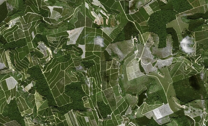
Airbus Defence and Space has been selected as the technical lead for the Coffee Canopy Partnership, a cross-industry initiative spearheaded by JDE Peet’s. The collaboration includes major global coffee entities such as Louis Dreyfus Company, Sucden, Neumann Kaffee Gruppe, and Tchibo, with institutional support from the UK Foreign, Commonwealth & Development Office (FCDO) and the UN Food and Agriculture Organization (FAO). The project's primary objective is the creation of a comprehensive, open-source map of global coffee plantations to verify deforestation-free production and enhance the resilience of the automotive data ecosystem applied to agricultural monitoring.
High-Resolution Satellite Remote Sensing
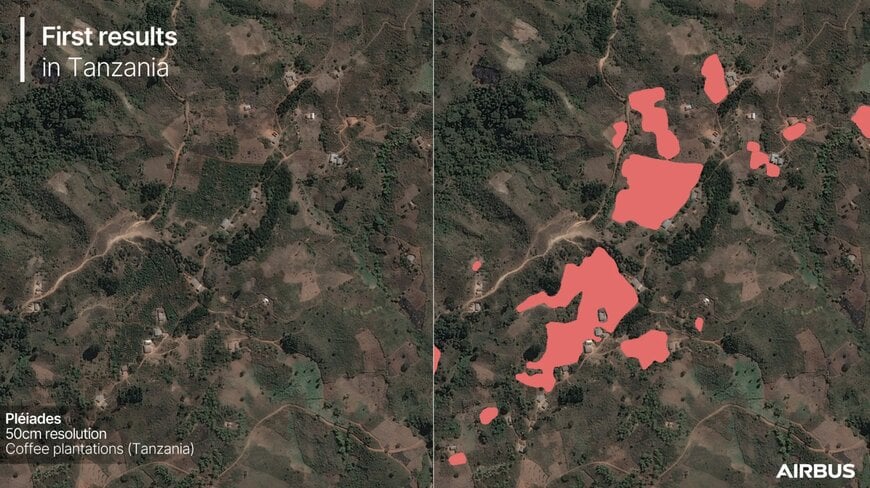
The technical foundation of the partnership relies on Airbus’s proprietary satellite constellations to achieve granular visibility into complex agricultural landscapes. By utilizing multispectral data from Pléiades (50 cm resolution) and Pléiades Neo (30 cm resolution), the system can distinguish coffee crops from surrounding vegetation, even in challenging environments like shade-grown and agroforestry systems.
Key technical components of the imaging phase include:
- Sub-Meter Precision: The use of 30 cm and 50 cm imagery allows for the identification of individual plot boundaries and canopy structures.
- Large-Scale Deployment: The initial phase has already covered over 1.2 million km² across East Africa, encompassing diverse topographical and climatic zones.
- Geospatial Intelligence: The high-resolution data provides the baseline for distinguishing between existing plantations and recent land-use changes.
AI Model Training and Predictive Analytics
To process the massive datasets generated by the Pléiades constellations, Airbus utilizes advanced artificial intelligence models trained on extensive agricultural datasets. These models are specifically tuned to recognize the unique spectral signatures and spatial patterns of coffee plants.
Technical capabilities of the AI integration include:
To process the massive datasets generated by the Pléiades constellations, Airbus utilizes advanced artificial intelligence models trained on extensive agricultural datasets. These models are specifically tuned to recognize the unique spectral signatures and spatial patterns of coffee plants.
Technical capabilities of the AI integration include:
- Automated Identification: The models autonomously categorize land use across vast areas, significantly reducing the manual labor required for landscape assessment.
- Deforestation Risk Modeling: By comparing historical data with current satellite feeds, the system identifies regions at high risk for deforestation, enabling proactive intervention.
- Scalability and Accuracy: Early results indicate a precision benchmark that facilitates the transition from localized monitoring to a global digital supply chain verification model.
Global Scaling and Ecosystem Resilience
Building on the East African pilot, the partnership aims to achieve worldwide coverage of all coffee-growing regions by 2027. This expansion will be funded through industry and institutional co-investment to ensure the long-term sustainability of the data platform.
The resulting maps are intended to serve as a shared resource for:
Building on the East African pilot, the partnership aims to achieve worldwide coverage of all coffee-growing regions by 2027. This expansion will be funded through industry and institutional co-investment to ensure the long-term sustainability of the data platform.
The resulting maps are intended to serve as a shared resource for:
- Governmental Policy: Supporting local and national land-management and restoration efforts.
- Livelihood Protection: Providing smallholder farmers with verifiable data to access premium "deforestation-free" markets.
- Supply Chain Transparency: Allowing roasters and traders to validate compliance with emerging environmental regulations.
This initiative represents a technical shift toward data-driven sustainability, where satellite-based "Canopy" monitoring provides a verifiable standard for environmental accountability in global agriculture.
Edited by Romila DSilva, Induportals Editor, with AI assistance.
Edited by Romila DSilva, Induportals Editor, with AI assistance.
